


Rocher de Tourte - 02-09-2020

nolsim
User
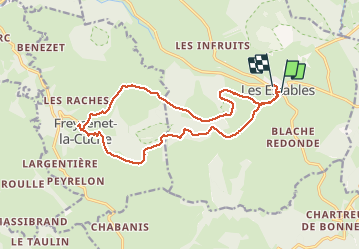

Length
16.8 km

Max alt
1464 m

Uphill gradient
430 m
Km-Effort
23 km

Min alt
1187 m

Downhill gradient
426 m
Boucle
No
Creation date :
2020-09-02 06:45:12.497
Updated on :
2020-09-02 12:14:29.769
4h09
Difficulty : Medium

FREE GPS app for hiking
 SityTrail
IGN / Geographical institutes
SityTrail Plus
The world is yours!
About
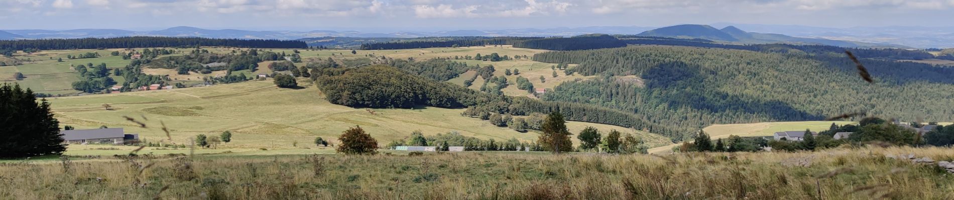
Trail Walking of 16.8 km to be discovered at Auvergne-Rhône-Alpes, Haute-Loire, Les Estables. This trail is proposed by nolsim.
Photos


Positioning
Country:
France
Region :
Auvergne-Rhône-Alpes
Department/Province :
Haute-Loire
Municipality :
Les Estables
Location:
Unknown
Start:(Dec)
Start:(UTM)
591342 ; 4972790 (31T) N.
Comments